Using Radar
Select Traffic and then Radar to see received position-reporting aircraft around the current GPS position. The display is north-up and centered on ownship.
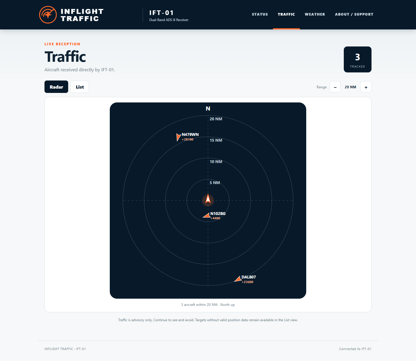
Relative altitude compares the target's reported altitude with the IFT-01 GPS altitude. For example, +4400 means approximately 4,400 feet above ownship. A target symbol's direction reflects reported track when that information is available.
Changing range
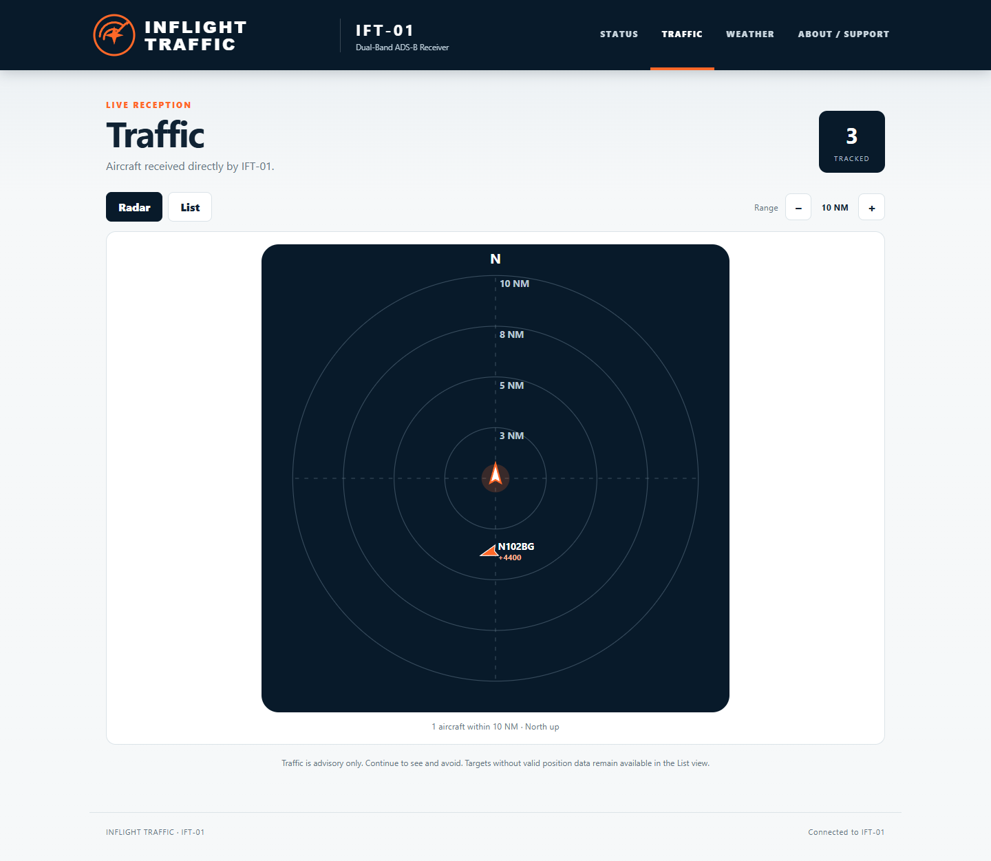
Use − for a closer view and + for a wider view. Aircraft beyond the selected radar range can remain in the tracked count and List view.
Aircraft without a usable position
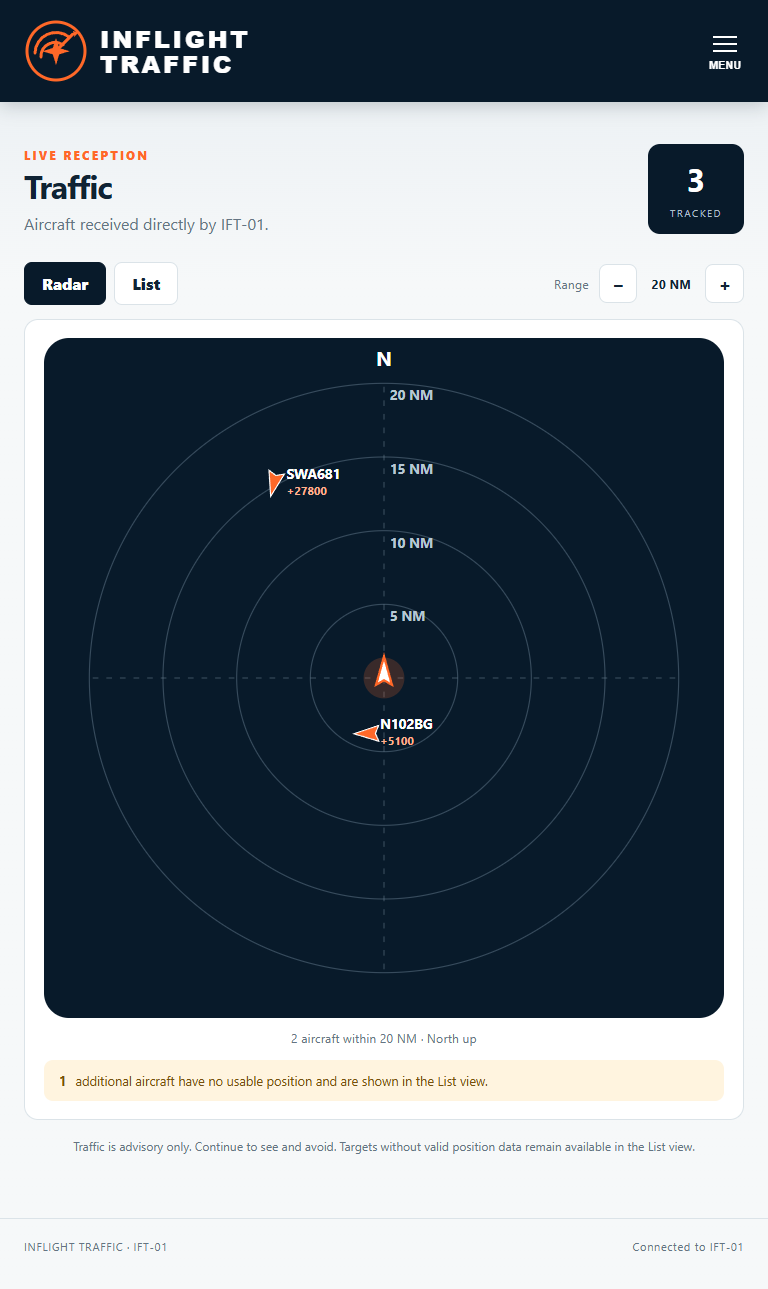
IFT-01 may receive identity, altitude or other ADS-B information without a current usable position. It does not invent a distance or bearing. Radar reports how many of these targets are available in List.
Using List
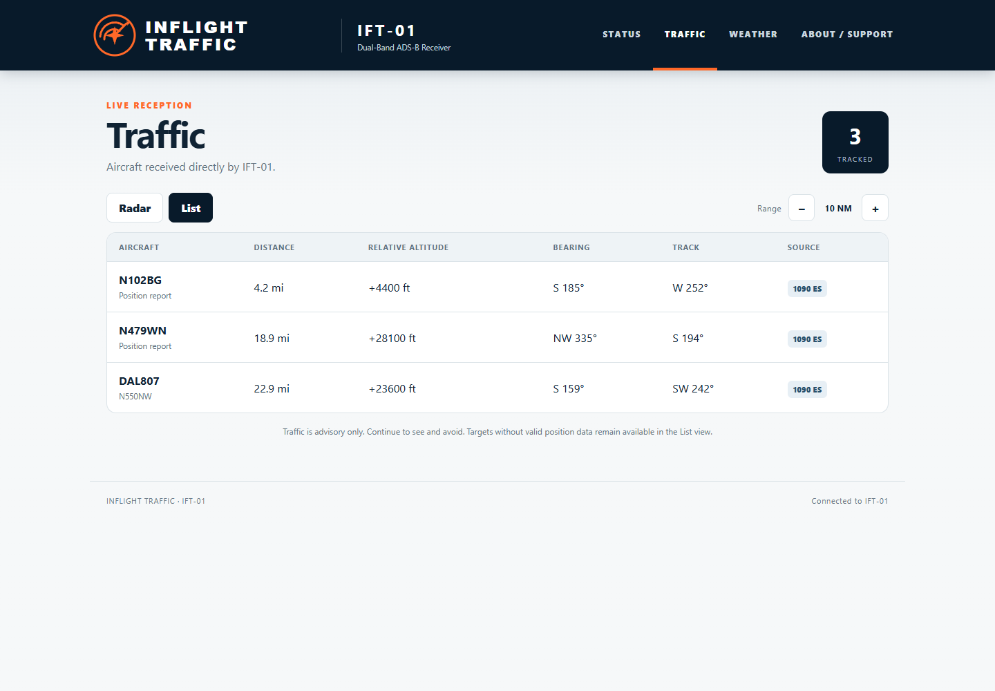
Select List for available target identifier, distance, relative altitude, bearing, reported track and source band such as 978 UAT or 1090 ES.
Traffic reception depends on aircraft equipment, altitude, distance, terrain, antenna placement and local radio conditions. Not all aircraft will appear. Radar and List are advisory only and are not collision-avoidance displays.